UTM Properties: Major Grid
The UTM Major Grid page allows you to define a grid lines using map unit
increments. It can be used in area where no culture grids are
available. There are also major Lines
that can be used to further customize the grid.
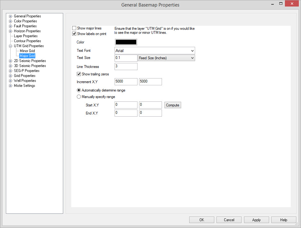
Enable Major Lines
Show Major Lines: Indicates that this item should be shown. Users may have either the major or major or both lines on.
Show Labels On Print: When printing, the
text indicating the X or Y value will be drawn at the outer edge of the
map.
Major Line Parameters
Color: Color of the grid lines.
Text Font, and Text Size: This specifies the font and the size of the text to be used as labels for the defined grid. Note: Fixed sized labels will remain the same regardless of the map scale. Variable sized labels will scale with the map scale.
Line Thickness: The thickness of the major grid lines in pixels.
Show trailing zeros: Displays the zeros at the end of labels.
Increment X,Y: The increment at which grid lines are spaced in the X and Y direction, specified in Map Units.
Automatically Determine Range: The current project extents will be used to create the grid, at the smallest possible increment value to the maximum possible increment value.
Manually Specify Range: Use this to manually set where the grid extents are.
Start X,Y: The starting points for annotation, specified in map units.
End X,Y: The ending points for annotation, specified in map units.
Compute:Sets
the Start and End X,Y to the current extent of the project. This can
then be adjusted as necessary.
Also See
— MORE INFORMATION

|
Copyright © 2020 | SeisWare International Inc. | All rights reserved |